
A challenging geometric problem: Derive the sun path (or day arc of the sun), the sun's trajectory in the sky, given a latitude, and the day of the year, e.g. 35° N, April 23.
I tried, and failed at first, to deduce accurately the shape of the sun paths. I then found sun path diagrams for specific latitudes here (for selected locations) and here* (for selected latitudes). See examples at the end of this post.
*carrying a wrong statement: "For a site located in the tropics between 23.5°N and 23.5°S, the sun will be in the North during the summer and in the South during the Winter." The correct statement is: "For a site located in the tropics between 23.5°N and 23.5°S, the sun will occupy only azimuths north of the E-W line (in the North) at the summer solstice and occupy only azimuths south of the E-W line (in the South) at the Winter solstice."
However, these sun path diagrams (linked above) do not reveal the simple geometry of the sun paths. Having fully thought through and understood the sun path geometry (I've not yet found a full description of this geometry online), I'll now briefly describe it:

Sun path geometry
These three diagrams show how sun paths can be readily determined.
Note that in the 50° N (latitude) diagram, the angle 40° (of the noon sun at the equinoxes) is computed thus: 40°=90°-50°. In general, the angle of the noon sun (from the horizon) at the equinoxes equals (90° - latitude). Also note that the angle between the noon sun at the equinox and the noon sun at the (summer and winter) solstice is always 23.5°, whatever the latitude. You can therefore draw a similar diagram for any latitude. (For example, the sun paths at 40°N are as follows.)
Note that in the 50° N (latitude) diagram, the angle 40° (of the noon sun at the equinoxes) is computed thus: 40°=90°-50°. In general, the angle of the noon sun (from the horizon) at the equinoxes equals (90° - latitude). Also note that the angle between the noon sun at the equinox and the noon sun at the (summer and winter) solstice is always 23.5°, whatever the latitude. You can therefore draw a similar diagram for any latitude. (For example, the sun paths at 40°N are as follows.)

sun paths at 40°N
Precisely stated, the sun paths at latitude L°N are formed by rotating the north polar (90°N) sun paths (shown above) by (90-L)°, clockwise when viewing from E to W, about the E-W axis.
The sun paths at latitude L°S are formed by rotating the north polar (90°N) sun paths by (90+L)°, clockwise when viewing from E to W, about the E-W axis.
More concisely (but using technical terms), when the sun's declination is d° (at a certain time of the year), the sun path is the d° small circle (parallel) of the celestial sphere. The latitude of the observer on earth determines the small circle's position in the sky (i.e. the degree of rotation from the north polar sun path).
Why do the sun paths follow the simple geometry shown above?
 |
| Standing upright at θ° N |
It is easy to see that, when you stand upright at the north pole, the sun paths are as shown in the 90° N diagram.
Standing upright at any other latitude (as shown in the above diagram) causes the sun paths to rotate in the way described earlier.
Sun's declination
To find out the sun's declination for any day of the year (+23.5° for the June solstice, 0° for the equinoxes, and -23.5° for the December solstice), you can use this table.
*******************************************************************************
Star Paths
The reason for the sun paths' geometry in fact also applies to the trajectory across the sky of all relatively stationary celestial bodies, i.e. stars and the moon.
Note that when the sun's declination is +23.5° (for the June solstice), the sun path is the +23.5° (23.5°N) small circle (parallel) of the celestial sphere. In general, when the sun's declination is d° (at a certain time of the year), the sun path is the d° small circle of the celestial sphere. The latitude of the observer on earth determines the small circle's position in the sky (i.e. the degree of rotation from the north polar sun path).
This fact is also true of all stars. If a star's declination is d°, then its path across the sky is the d° small circle of the celestial sphere. The latitude of the observer on earth determines the small circle's position in the sky (i.e. the degree of rotation from the north polar star path).
The North Star (northern pole star)'s declination is +90°, and therefore appears stationary in the sky. All other stars appear to rotate around the northern and (imaginary) southern pole stars (currently there is no star at declination -90°).

Long exposure (45 min) photo (facing north) of the northern sky (50°N)
around North Star, showing the +40° to +90° small circles
(which are completely visible in the sky) of the celestial sphere (source)
Moon Path
Because the moon's orbital plane around the earth is close to the earth's orbital plane around the sun (the ecliptic), the moon's declination ranges from -23.5° to +23.5° (approximately; for a precise range, see here) through a lunar cycle (a sidereal month of 27.32 days, slightly shorter than the period of moon's phases (synodic month) of 29 days, 12 hours, 44 minutes) (see diagrams below).

Moon's declination, June 2012 (source)
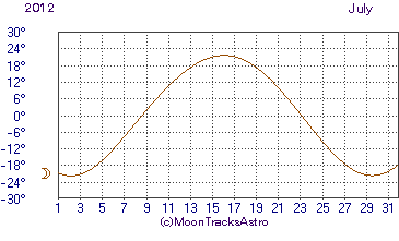 |
| Moon's declination, July 2012 |
Therefore the moon path is approximately within the range of the sun path, from -23.5° to +23.5° parallel.
For detailed data on lunar declination from 2001-2100, see here.
Lunar Phases and Appearance (Shape) of the Moon

Appearance of the Moon at the North Pole. The upper part of the diagram is not to scale,
At any phase of the moon, the lit portion of the moon indicates the sun's position relative to the moon. The moon moves along a d° small circle of the celestial sphere, where d° is the moon's declination.
At the north pole, the moon's appearance is as shown above, and right (→) is the direction of the moon's advance along the small circle of the celestial sphere. The first quarter moon has the right half lit. The last quarter moon has the left half lit. The moon moves right along a celestial small circle.
Identically with the sun path and star paths, the moon's path (a celestial small circle) occupies a rotated position (from its north polar position) in the sky according to latitude. The first quarter moon's lit half always points to the moon's direction of advance through the night. Likewise the last quarter moon's dark half always points to the moon's direction of advance through the night. (see photos below, possibly taken from space)
At the equator, the first quarter moon rises with top half lit, and sets with the bottom half lit. The last quarter moon rises with the bottom half lit, and sets with the top half lit.
At the south pole the The first quarter moon has the left half lit. The last quarter moon has the right half lit. The moon moves left.

First quarter moon rising (noon, invisible),
or last quarter moon setting (noon, invisible), at the equator

First quarter moon setting (midnight),
or last quarter moon rising (midnight), at the equator

First quarter moon rising (around noon, invisible) at mid Northern hemisphere, or
last quarter moon setting (around noon, invisible) at mid Southern hemisphere.

First quarter moon setting (around midnight) at mid Northern hemisphere, or
last quarter moon rising (around midnight) at mid Southern hemisphere.

Last quarter moon rising (around midnight) at mid Northern hemisphere, or
first quarter moon setting (around midnight) at mid Southern hemisphere.

Last quarter moon setting (around noon, invisible) at mid Northern hemisphere, or
first quarter moon rising (around noon, invisible) at mid Southern hemisphere.
                       2012 Phases of the Moon
                            Universal Time

        New Moon   First Quarter       Full Moon    Last Quarter

         d  h  m         d  h  m         d  h  m         d  h  m

                    Jan  1  6 15    Jan  9  7 30    Jan 16  9 08
    Jan 23  7 39    Jan 31  4 10    Feb  7 21 54    Feb 14 17 04
    Feb 21 22 35    Mar  1  1 21    Mar  8  9 39    Mar 15  1 25
    Mar 22 14 37    Mar 30 19 41    Apr  6 19 19    Apr 13 10 50
    Apr 21  7 18    Apr 29  9 57    May  6  3 35    May 12 21 47
    May 20 23 47    May 28 20 16    Jun  4 11 12    Jun 11 10 41
    Jun 19 15 02    Jun 27  3 30    Jul  3 18 52    Jul 11  1 48
    Jul 19  4 24    Jul 26  8 56    Aug  2  3 27    Aug  9 18 55
    Aug 17 15 54    Aug 24 13 54    Aug 31 13 58    Sep  8 13 15
    Sep 16  2 11    Sep 22 19 41    Sep 30  3 19    Oct  8  7 33
    Oct 15 12 02    Oct 22  3 32    Oct 29 19 49    Nov  7  0 36
    Nov 13 22 08    Nov 20 14 31    Nov 28 14 46    Dec  6 15 31
    Dec 13  8 42    Dec 20  5 19    Dec 28 10 21
|
(source)
Rising and setting of the Moon
The sun is at its upper culmination (highest point in the sky), crossing the observer's meridian, at noon. The new moon is at its upper culmination also at noon (i.e. the moon is then between the sun and the earth). The moon culminates (at its highest point in the sky) at 3 pm at waxing crescent, 6 pm at first quarter, 12 midnight at full moon, and 6 am at last quarter. (see Lunar phase)
At the equator, the moon rises about 6 hours before culmination, and sets about 6 hours after culmination. Elsewhere, the declination of the moon and the observer's latitude determines the exact time of the moon's rising and setting..
Thus, in the following table, the lunar phase determines the moon's meridian passing (upper culmination) time. The moon's declination and latitude determine the moonrise and moonset azimuth and the meridian passing altitude. The lunar phase, the moon's declination, and latitude determine the moonrise and moonset time.
For similar information on the moon path (and the sun path) at various locations, see here.
Rising and setting times for the Moon. London, July 2012 (source)
All times are in local time for London (BST=UTC+1h)(table explanation) (
| Time,local | Azimuth | Meridian Passing | |||||||
|---|---|---|---|---|---|---|---|---|---|
| Date | Moonrise | Moonset | Moonrise | Moonset | Time | Altitude | Distance | Illuminated | Phase |
| (km) | |||||||||
| 1 Jul 2012 | - 19:04 | 02:27 - | - 126° | 235° - | 23:14 | 15.9° | 362,389 | 95.1% | |
| 2 Jul 2012 | - 20:05 | 03:23 - | - 126° | 233° - | |||||
| 3 Jul 2012 | - 20:54 | 04:30 - | - 123° | 235° - | 00:16 | 16.4° | 363,485 | 99.0% | Full Moon at 19:52 |
| 4 Jul 2012 | - 21:32 | 05:45 - | - 117° | 239° - | 01:16 | 18.4° | 366,204 | 99.8% | |
| 5 Jul 2012 | - 22:02 | 07:04 - | - 111° | 245° - | 02:14 | 21.7° | 370,353 | 97.7% | |
| 6 Jul 2012 | - 22:27 | 08:22 - | - 103° | 252° - | 03:07 | 25.9° | 375,566 | 92.9% | |
| 7 Jul 2012 | - 22:49 | 09:37 - | - 95° | 260° - | 03:56 | 30.6° | 381,369 | 86.1% | |
| 8 Jul 2012 | - 23:09 | 10:49 - | - 88° | 269° - | 04:43 | 35.5° | 387,254 | 77.7% | |
| 9 Jul 2012 | - 23:29 | 11:59 - | - 80° | 276° - | 05:28 | 40.4° | 392,751 | 68.3% | |
| 10 Jul 2012 | - 23:50 | 13:07 - | - 73° | 284° - | 06:12 | 45.0° | 397,473 | 58.5% | |
| 11 Jul 2012 | 14:13 | 291° | 06:55 | 49.2° | 401,138 | 48.5% | Third Quarter at 02:48 | ||
| 12 Jul 2012 | 00:13 | 15:18 | 67° | 296° | 07:40 | 52.8° | 403,571 | 38.7% | |
| 13 Jul 2012 | 00:39 | 16:21 | 62° | 301° | 08:25 | 55.7° | 404,701 | 29.5% | |
| 14 Jul 2012 | 01:11 | 17:21 | 57° | 305° | 09:12 | 57.8° | 404,561 | 21.0% | |
| 15 Jul 2012 | 01:49 | 18:16 | 55° | 306° | 10:00 | 59.0° | 403,277 | 13.6% | |
| 16 Jul 2012 | 02:34 | 19:04 | 54° | 306° | 10:50 | 59.2° | 401,050 | 7.5% | |
| 17 Jul 2012 | 03:28 | 19:45 | 55° | 303° | 11:40 | 58.3° | 398,128 | 3.1% | |
| 18 Jul 2012 | 04:29 | 20:20 | 58° | 299° | 12:30 | 56.3° | 394,760 | 0.6% | |
| 19 Jul 2012 | 05:36 | 20:50 | 63° | 294° | 13:19 | 53.3° | 391,174 | 0.3% | New Moon at 05:25 |
| 20 Jul 2012 | 06:46 | 21:15 | 69° | 287° | 14:08 | 49.5° | 387,548 | 2.2% | |
| 21 Jul 2012 | 07:59 | 21:38 | 76° | 280° | 14:55 | 44.9° | 384,013 | 6.4% | |
| 22 Jul 2012 | 09:12 | 22:00 | 84° | 272° | 15:43 | 40.0° | 380,654 | 12.9% | |
| 23 Jul 2012 | 10:27 | 22:22 | 92° | 264° | 16:31 | 34.9° | 377,523 | 21.3% | |
| 24 Jul 2012 | 11:44 | 22:45 | 101° | 256° | 17:20 | 29.8° | 374,659 | 31.4% | |
| 25 Jul 2012 | 13:01 | 23:12 | 109° | 248° | 18:11 | 25.1° | 372,108 | 42.7% | |
| 26 Jul 2012 | 14:19 | 23:43 | 116° | 241° | 19:05 | 21.0° | 369,955 | 54.5% | First Quarter at 09:56 |
| 27 Jul 2012 | 15:36 | - | 122° | - | 20:02 | 18.0° | 368,335 | 66.2% | |
| 28 Jul 2012 | - 16:49 | 00:23 - | - 126° | 237° - | 21:01 | 16.3° | 367,431 | 77.1% | |
| 29 Jul 2012 | - 17:52 | 01:12 - | - 126° | 234° - | 22:02 | 16.1° | 367,439 | 86.4% | |
| 30 Jul 2012 | - 18:45 | 02:13 - | - 125° | 234° - | 23:02 | 17.4° | 368,522 | 93.5% | |
| 31 Jul 2012 | - 19:27 | 03:23 - | - 120° | 237° - | 23:59 | 20.0° | 370,752 | 98.1% | |
******************************************************
Some sun path diagrams

Equator

London, UK (51.4°N)

Arctic circle

Equator

London, UK (51.4°N)

Arctic circle
Source: All the following diagrams are from here, where you can specify the location and date of the sun path you want.

Sun path at Qanaq (Qaanaaq), Greenland (77°29′00″N, above the Arctic Circle) at summer solstice
 |
| Sun path at Trondheim (63°25′N, just below the Arctic Circle) at summer solstice |

Sun path at Hong Kong (22°19′N, near Tropic of Cancer) at summer solstice
 |
| Sun path at Quito (near the Equator, 0°13′S) at March equinox |
 |
| Sun path at Quito (near the Equator, 0°13′S) at June solstice |
 |
| Sun path at Bangkok, Thailand (13°55′N) at June solstice |
 |
| Sun path at Bangkok, Thailand (13°55′N) at December solstice |
Why does the setting waxing crescent moon appear more horizontal (seem to smile more) in winter than in summer in the Northern hemisphere?
A reader of this post has asked about the phenomenon that the waxing crescent moon (following the new moon), when observed setting in the west in mid-northern latitudes, appears to be more horizontal (like a smile) in winter than in summer.
A common, but wrong, interpretation is that the moon path in winter is different from that in summer, as shown in this diagram:

Wrong picture!
There is absolutely no reason why the moon path should differ in this manner.
The moon path intercepts the western horizon at exactly the same angle (given any fixed latitude) at all times of the year.
The following is the right picture, showing that the crescent moon tilts but the moon path remains the same:

The explanation of this tilt is as follows:
For background knowledge, first read the section above on Lunar Phases and Appearance (Shape) of the Moon.
 |
| Appearance of the Moon at the North Pole |
For the Moon to appear (called the standard appearance) as shown in the above diagram, a specific relation (called the special configuration) on the positions of the earth, the moon and the sun must hold.
You may skip the following description of the special configuration, the understanding of which requires some careful thought.
*****************************************
Special Configuration
Consider an observer K of the Moon on Earth's North Pole. The boundary C of the Moon's observable hemisphere (assuming full moon) is a great circle. Let's impose circles of longitude (meridians) on the moon thus: Let the top and bottom of the Moon (on C) as seen by K be the Moon's poles. A Moon's meridian is a great circle, such as C, that contains both poles.
For the Moon to appear as shown above with the standard appearance, the boundary of the Moon's Sun-illuminated hemisphere must be a meridian.
This in turn implies that the Sun must lie on the Moon's Equatorial plane (the plane normal to its polar axis and containing its center). This is the special configuration mentioned above.
*******************************************
Near the June solstice, the sun's declination is high (near +23.5°). Thus it is probable the the sun's declination is higher than what the special configuration requires, which in turn causes the moon shape as seen in the North Pole to tilt in the following manner compared with the standard appearance because the sun now illuminates a different portion of the moon.
|
| Shape of first quarter moon (tilt exaggerated) at North Pole |
Near the December solstice, the sun's declination is low (near -23.5°). Thus it is probable the the sun's declination is lower than what the special configuration requires, which in turn causes the moon shape as seen in the North Pole to tilt in the following manner compared with the standard appearance because the sun now illuminates a different portion of the moon.
|
| Shape of first quarter moon (tilt exaggerated) at North Pole |
The moon shape seen at any latitude likewise tilts (see the section above on Lunar Phases and Appearance (Shape) of the Moon for how latitude determines moon shape).

This explains why the waxing crescent moon, when setting in the northern hemisphere, probably smiles more in winter than in summer.
***************************************
The following table gives the approximate data on the Moon's declination, the Sun's declination as required by the special configuration (A), the Sun's actual declination (B), and their difference (B-A), two days after the new moons (i.e. at the first observable waxing crescent moon) in 2015.
The sun's deviation from its special configuration is 11.49° on 7/18/2015, and -13.94° on 2/21/2015, making a total deviation of 25.43°. This is certainly noticeable, and explains the above mentioned shift in moon shape.
| Date | moon's declination | A. special config | B. sun's declination | B-A |
| 1/22/2015 | -8.40 | -7.65 | -19.87 | -12.22 |
| 2/21/2015 | 3.37 | 3.07 | -10.87 | -13.94 |
| 3/22/2015 | 9.98 | 9.08 | 0.40 | -8.68 |
| 4/21/2015 | 17.15 | 15.58 | 11.65 | -3.93 |
| 5/20/2015 | 18.38 | 16.69 | 19.85 | 3.16 |
| 6/18/2015 | 17.08 | 15.51 | 23.40 | 7.89 |
| 7/18/2015 | 10.60 | 9.64 | 21.13 | 11.49 |
| 8/16/2015 | 4.83 | 4.40 | 13.93 | 9.53 |
| 9/15/2015 | -5.13 | -4.67 | 3.27 | 7.94 |
| 10/15/2015 | -13.73 | -12.48 | -8.30 | 4.18 |
| 11/14/2015 | -18.20 | -16.53 | -18.07 | -1.54 |
| 12/13/2015 | -17.77 | -16.14 | -23.12 | -6.98 |
The sun's pattern of deviation from its special configuration varies from year to year. The maximum declination of the moon plays an important role in the pattern.
October 2015 sees a minor lunar standstill, when the moon's maximum declination is at its minimum.
The following tabulates the same set of data for 2006. In June 2006 there was a major lunar standstill, when the moon's maximum declination is at its maximum.
| Date | moon's declination | A. special config | B. sun's declination | B-A |
| 1/2/2006 | -24.23 | -21.95 | -22.85 | -0.90 |
| 1/31/2006 | -18.12 | -16.45 | -17.63 | -1.18 |
| 3/2/2006 | -6.33 | -5.76 | -7.87 | -2.11 |
| 3/31/2006 | 7.57 | 6.89 | 3.62 | -3.27 |
| 4/30/2006 | 20.50 | 18.60 | 14.20 | -4.40 |
| 5/29/2006 | 28.49 | 25.75 | 21.50 | -4.25 |
| 6/28/2006 | 24.52 | 22.21 | 23.12 | 0.91 |
| 7/27/2006 | 19.90 | 18.06 | 19.45 | 1.39 |
| 8/26/2006 | 9.53 | 8.67 | 11.07 | 2.40 |
| 9/24/2006 | -3.85 | -3.51 | 0.03 | 3.54 |
| 10/24/2006 | -17.50 | -15.89 | -11.22 | 4.67 |
| 11/23/2006 | -28.44 | -25.70 | -20.03 | 5.67 |
| 12/22/2006 | -24.52 | -22.21 | -23.50 | -1.29 |
The largest positive deviation of the sun's declination (5.67°) in 2006 occurred near the December solstice, and the largest negative deviation of the sun's declination (-4.40°) in 2006 occurred near the June solstice. The magnitude of the deviations were small throughout the year.
The above mentioned shift in crescent moon shape is therefore not an unchanging phenomenon observable every year.
* For computing column A. above, I used the geometry and trigonometry here.
*******************************************************************
Thank you so much for this stunning exposition!
ReplyDeleteI have come upon only now and I am going to study it and master the principles, so that I will be able to set up all my solar-powered contraptions and inventions and also have the ability to help other people with similar aspirations.
This comment has been removed by the author.
ReplyDeleteHi, about to study it for my own purpose: Sunshade. I live in bangkok, where sunshade are put above kids instead of between the kids and the sun. So sometime they just don;t work when time is needed. If you have any idea, please help.
ReplyDeleteI would first find out the lowest altitude of the sun during the year in the directions (azimuth) where I want shielding.
DeleteExamine the sun path diagrams for Bangkok (which I have newly added to the end of my blogpost above) at the solstices (when the sun path is at the extremity of its range). [Visit http://sunposition.info/sunposition/spc/locations.php#1 for more.]
Take 45° azimuth (NE) as an example. The lowest altitude of the sun at 45° azimuth is 76° (during the June solstice). Thus if the sun shade's altitude (measured from the spot to be shaded) in the 45° azimuth is 70° or less, then the shade works well in the 45° azimuth.
I would work out the required altitude in all the azimuths needed.
The azimuths 66°-114° (East) and 247°-295° (West) cannot be fully shaded as the sun rises and sets in these azimuths sometime during the year.
being as EVERY PERSON on this planet from rise to set looking twice in 12 hours seeing the same thing the moon flipping 180's at allll latitudes every 12 hours, this field rotation is out of date and not needed anymore for dazzthecameraman has made 6-7 videos using my name in the title tyo express how normal it is for field rotation to flip the moon regardless latitude, so either he is right or your right, im going to have to side with you, this is not normal,can we get a reading on how much of the extra 153 degree angular shift i am seeing is earth tilting on its axis?
ReplyDeletePlease provide the same data for the Southern Hemisphere.
ReplyDeleteThe southern hemisphere data is exactly the same as northern hemisphere, but inverted.
DeleteI've provided links to the sources for the data in this post. I think if you look up the sources, you would find the data for locations in the Southern Hemisphere. However, if this is not true, then please specify which data, and I will find the relevant source.
ReplyDeleteThe sun path diagrams at the end of the post are from here: http://sunposition.info/sunposition/spc/locations.php#1
ReplyDeleteExcellent article. Can you clarify the exact reason why the sunarcs are different in relation to the western horizon when the sun sets based on the time of year? This is empirically the case and I have seen it written. But do not understand visually why this is. It seems that during the vernal equinox the angle of the sun setting with the horizon is close to 90 degress (for an observer in the Northern hemisphere say at 40N) and much more acute at the autumnal equinox. Please explain why exactly this is so. Much appreciated. Thanks!
ReplyDeleteThank you. I am not aware of the phenomenon that you described, and cannot explain why there should be any difference between the sunpaths at the spring and the autumn equinoxes.
DeleteHi. Thanks. Please see here under post from March 31, 2014 to see what I am referring to.
ReplyDeletehttp://astrobob.areavoices.com/tag/ecliptic/
I believe that the moon path at the vernal equinox is the same as that at the autumnal equinox, but the sun illuminates a slightly different hemisphere of the moon (when viewed from Earth) at these times. This explains the different positions of the moon's visible crescent relative to the moon path, and therefore to the horizon.
DeleteThis is in turn due to the fact that the moon's orbital plane is not exactly the ecliptic.
That diagram here ( http://en.m.wikipedia.org/wiki/Lunar_standstill#Detailed_explanation ) might clarify this fact.
This comment has been removed by the author.
DeleteThe above was my reply, using an alias (involuntarily) due to some software bug. I now retract the explanation concerning the ecliptic and the lunar orbital plane. See the blogpost for a simple and correct explanation.
DeleteI'm still confused as to the relationship between the moon path in a given season vs.the sun path. I can't see anywhere where the moon path would be affected by the season of the year (i.e. the point at which the sun is on the ecliptic).
ReplyDeleteIt seems that the only affects on the moon path are:
1) the declination which is affected by the 18.6 year nodal cycle and
2) the latitude of the observer (let's assume a mid latitude on the Northern Hemisphere).
Is there any intuitive reason that the setting angle of the new moon would be at an acute angle with the horizon every spring and be close to vertical every fall? That is what many claim empirically and what is shown here:
http://astrobob.areavoices.com/tag/ecliptic/#sthash.o9SOqscF.dpuf
Thanks!
Thanks!
I have just added a section towards the end of this blogpost to explain in more depth. Please let me know if and where it isn't clear. Thanks.
DeleteMy earlier explanation was wrong. I've now replaced it with a very simple and correct (I believe) explanation
DeleteThanks so much. The ecliptic does indeed make a vertical path over the night sky during the spring and a shallow path in the fall. Since the moon is along this path more or less (+/- 5 degrees) it does appear high in the sky and to the north of the sun at dusk in the springtime. However, you are correct, as it sets in the western horizon, it does so at a constant angle (for a given latitude) no matter what day of the year.In contrast, in the fall, the ecliptic is indeed shallow over the moonpath and as such the moon is low in the sky at dusk. However, as it sets, it does so at the same angle as it did in the spring or any other day of the year. But the position along the western horizon is farther to the south. Would be easier to see with diagrams showing how the moon, along the ecliptic, moves over the night sky from sunset to dawn.
DeleteYou're welcome. As the moon's declination changes from -23.5° to +23.5° (approximately) in 13.7 days (half a sidereal month), it is perhaps not easy to visually determine the moon path. Systematic photography is perhaps the best way to empirically determine the moon path.
DeleteThe above applies to one in the Northern Hemisphere.
ReplyDeleteI would like to get Moon Path Diagram like Sun Path Diagram. Is it possible?
ReplyDeleteThis comment has been removed by the author.
ReplyDeleteThank you for a wonderful article. I wish I had read this excellent blog post about the Moon before I wrote my own - anyway, I hope you like this write up ... it's aimed at beginners who want to learn the Moon Phases names.
ReplyDeleteThank you for a very illuminating article. I would enjoy reading the proof of why sun paths follow the simple geometry you show here. Without a formal proof, I can still intuitively grasp the idea of a sun path as a small circle in the celestial sphere, corresponding to the declination of the sun at a given date, by rotating the polar sun path in the mind's eye.
ReplyDeleteThe sun paths obtained with the SunPosition.info website for mid-latitudes show an arc of this small circle nicely. I must be missing something, though, because I fail to see why the paths obtained for high latitudes and low latitudes deviate so much from an arc of a circle (an oblong curve at low latitudes vs. a bell-shaped curve at high latitudes). I would be very grateful for explanation for these non-circular paths.
PS. Unfortunately, the link for your very clear first figure is broken (not an unusual fate for links, alas).
Thank you for your compliment. I have added a diagram to show why the sun paths follow the simple geometry. I hope that helps.
DeleteConsider a semi-circular sun path that rises at 90° azimuth (exact East), passes exactly overhead, and sets at 180°azimuth (exact West).
The sun occupies only two azimuths, 90° and 180°. Therefore we have the Π shape of the chart (in the blogpost) for Quito at Equinox.
All sun paths are arcs (of a circle). The charts do not show the actual shapes of the sun paths.
I'm grateful for your response and your clear explanation. The new figure does indeed illustrate the geometry clearly. My mistake was to misinterpret the SunPosition.info charts as an illustration of the shape of sun paths, rather than the altitude vs. azimuth graph they really are. Thank you.
ReplyDelete